
It happens every time I open my Big Book Atlas, without fail. Children can’t sit! They are drawn to the big maps, swarming like bees to flowers.
 .
.
Do you have any idea how many different things children want to say when they see a big map of America? They are bursting to recognize states and tell me where they have traveled. They can’t sit still; they just have to stand. Little ones have big minds that are much like sponges, wanting and needing to soak it all up. Learning should be exciting, yet learning with the Big Book Atlas is thrilling.
Why does this big map book hit a nerve?
Here is what happened this week, and how a ‘moment’ can instantly become a passion of learning for children. Emergent curriculum at its best.
Chloe brought in a book about animals.
 Instead of picking a few pages to read, I asked what animal they wanted to learn about. Salamander was the vote, so we went to the index to find “S” and salamander. There were subheadings, which I read aloud, and “mudpuppy” sounded interesting. I read that mudpuppies live in the northeast. Blank stare. “Do you know what the northeast is?”, I asked. No takers.
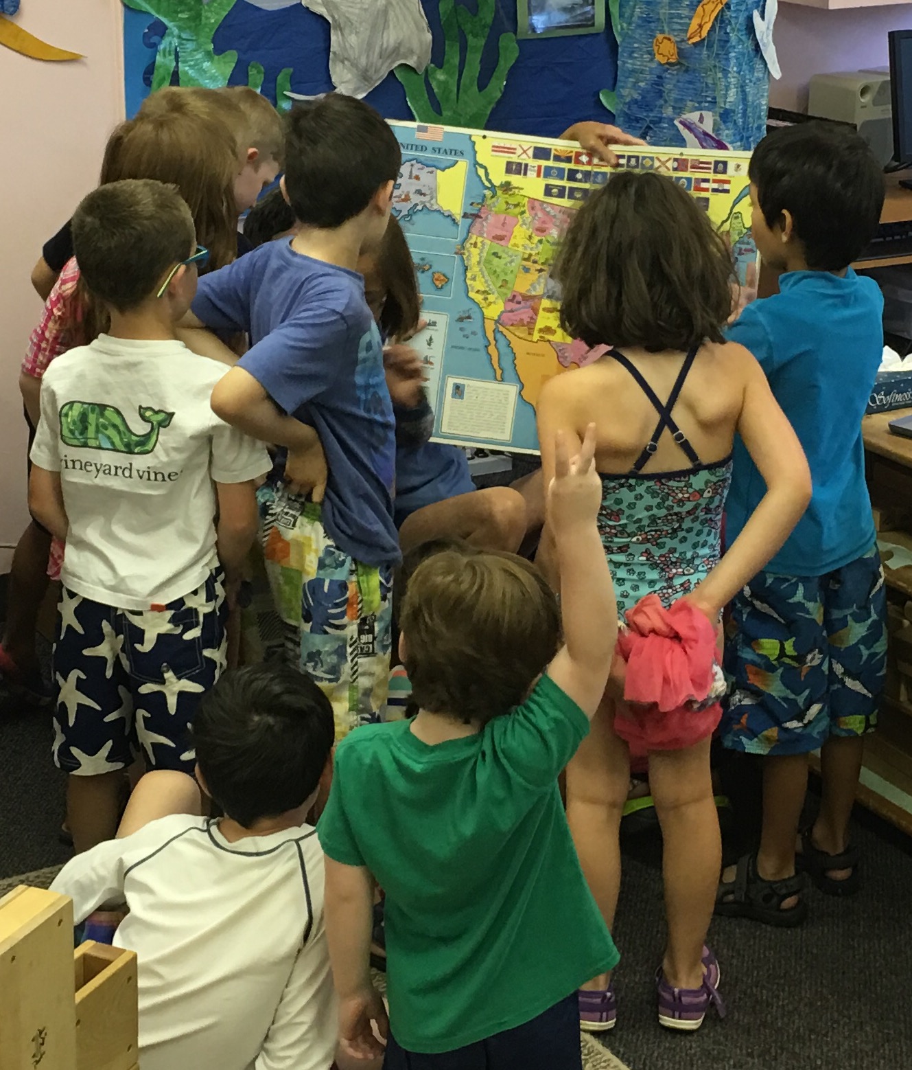
I knew just what to do. Big Book Atlas to the rescue.
I jumped up and said, “I have something really cool to show you. Stay right there!” I dashed to find the Big Book Atlas, opened it up to the United States, and simply pointed as I said, “North. East. We’re both north and east. That’s where mudpuppies live.”
At this point children didn’t care about mudpuppies. They wanted to learn more about north and east, and also south and west. We talked about many different animals and where they lived. Rattlesnakes, included. Henry was proud to tell everyone that it would take five hours to drive to Pennsylvania, and five days to drive to California. We traced the route on the map. Along the way we stopped to look at the mountains in the west with snow peaks. Children traced rivers with their fingers into the gulf and the oceans.
Rattlesnakes came up in the conversation again. I turned to the map of the world to show children where it was hot, like the southwest. “Where is the hottest place in the world?” I asked. Fifteen fingers and pushing, excited children guessed. Of course we learned about the equator.
Then Neil remarked about pirates while looking at the oceans. Another child said there are no pirates. I calmly said, “Yes there are some pirates today.” Wide eyes and silence. “I’ll show you where they are.” We flipped to the map of Africa and I showed them the area called the horn, or Somalia. Oh, how we talked!
I read the names of oceans and seas. “I know that place!”, another child said when we followed the Red Sea north from Somali. “Where is Jerusulum?” Four of us looked together, but alas, the map of Africa did not extend north enough to identify the city of Jerusalem.
We finished this great, unplanned episode of learning. All of this took thirty minutes. This was the most important thirty minutes of their day.
The next day as soon as Will arrived at camp he said, “Jennie, I found Jerusalem last night. I’ll show you on the map.”
Jennie

I’m a kid around maps. I don’t know what it is about them, but I can muse over them for hours. I’m not surprised the kids love it 😀
Thank you! They certainly did. It was so interesting how the map allowed learning to go from one thing to the next, etc.
Thank you for sharing this story with us, Jennie. I loved hearing about the children’s enthusiasm for learning. It is great for them to have a teacher who encourages their curiosity and maintains their enthusiasm for learning. They know so much more than what will ever be tested by standards. They are learners for life.
You are welcome, and thank you for your kind words!
Norah, I have nominated you for the Spirit Animal Award. I had difficulty posting this on your blog site,so please go to https://jenniefitzkee.com/2016/08/13/the-spirit-animal-award-nomination/
I love all this. In my next life I will be a teacher- meanwhile, I’m practicing on my grandchildren!
Awww…many thanks! Glad you enjoyed the post.
Excellent idea, Jennie! I love reading about how the children responded.
Thank you, Tanya!
Such a great story! I love a good map as well. I think I’d enjoy your class very much. 🙂
Thank you, Lynn.
I love how your writings whisk me into Wonder Land. Thank you. I once kept a world map pinned to my dining room wall, for my son and I. We explored places to live or not live. 🙂 ren
You are welcome. And, thank you for reading ‘wonderland’
Meant to say that your kind words are greatly appreciated. Maps are pretty cool and exciting.
Reblogged this on Roberta Pimentel.
Many thanks, Roberta!
Children are always fascinating 🙂 Very Interesting read 🙂
Thank you!
Kids respond to spontaneity, and you found a way to help their learning flourish with a fun and memorable approach. Excellent post!
Thank you so much!
Reblogged this on Still Another Writer's Blog.
So Interesting to read about Enthusiastic Youngsters, and their Inspiring Teacher. …India is buying nuclear reactors from the West, but these kinds of Teaching methods are carefully kept at bay. …Thanks for sharing. This was uplifting! Love to the Children and to You! 🙂
Many thanks. I’m so glad this uplifted you! I teach many children from India, and their family unit is strong, and they value education. It is wonderful.
Nice to know all this! Hearty Regards. 🙂
The best learning!
I remembere pouring over maps as a kid and any animal bokks especially with pictures. Great teaching aids ☺
Thank you. Of course I completely agree! 🙂 Jennie
Wonderful to encourage the love of maps!
It sparks so many conversations and curiosities.
I am not sure how I missed this, but I love how you instill curiosity in your group of children. This is a great example for parents, teachers and one particular Nana! 😉
Thank you, Robin!